Location

Location

September 2, 2021 2022-01-24 11:32

Discover Olympiada

Olympiada is a village in the northeastern part of the peninsula of Chalkidice, Greece.

It is a municipal district of the same name, within the municipality of Aristotle.  The distance from Ierissos is 35 km and 90 from Thessaloniki.

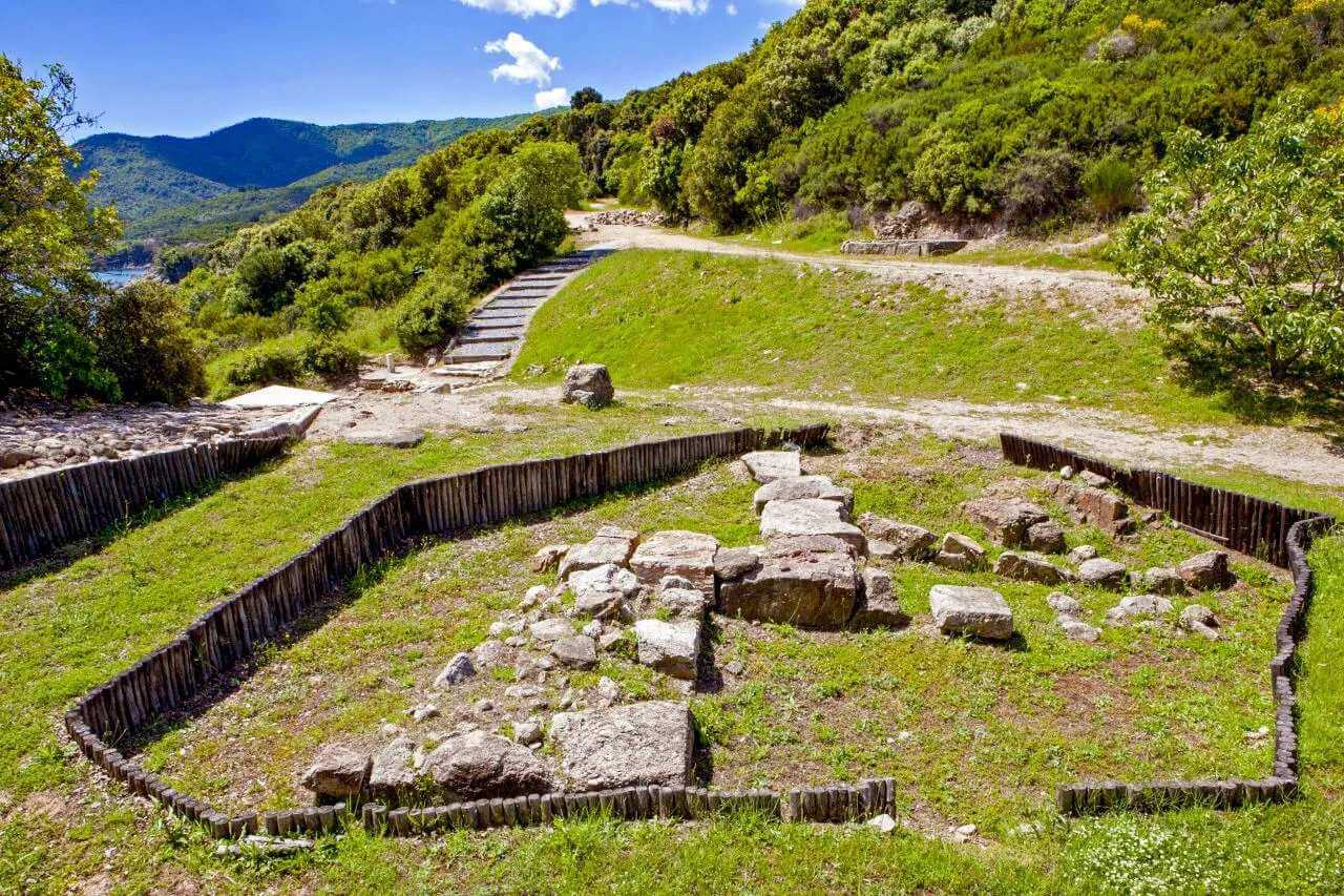
Approximately 700 meters from it lies the archaeological site of ancient Stagira. The area is declared as a protected zone by the Natura 2000 programme.

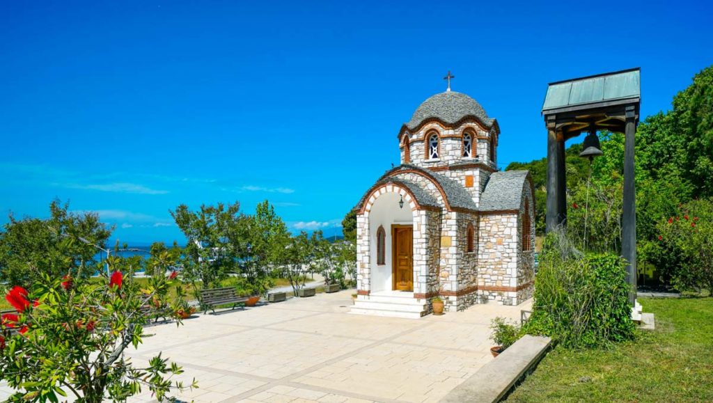
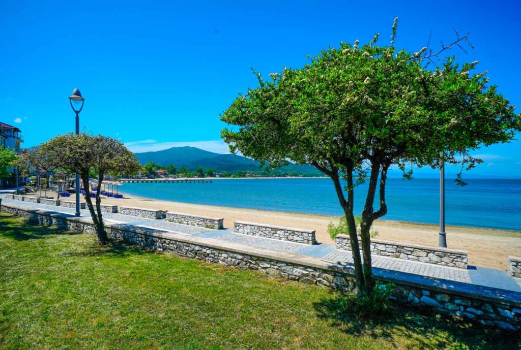
The location of Afros Suites, Olympiada, is a great place full of astonishing sandy beaches with white, fine sand. Considering the historical background, Olympiada is also an important archeological location because of Ancient Stageira, the birthplace of Aristotle. You can visit interesting sites and do fun activities while staying at Afros Suites.

Directions

Getting here

Olympiada is located in the northeastern side of Chalkidiki Greece, within the Strymonikos gulf.

By Car

The road to access Olympiada, is via Stavros (the nearest town) at a distance of 12 km. From Thessaloniki, Olympiada is 90 km away via the new National Road Thessaloniki – Kavala (Egnatia Motorway). From Kavala, the road distance is 99 km via Egnatia Motorway. From Serres, Olympiada is 98 km away via the National Road of Serres – Drama, or alternatively 82 km away via Nigrita (country road).

By Airplane

The closests airports are the ones in Thessaloniki (Thessaloniki Airport Makedonia – SKG) which is approximately 100km from Olympiada and the one in Kavala (Kavala Airport “Alexander the Great” – KVA) which is approximately 128km from Olympiada. Both airports receive numerous flights from all over Europe especially during the summer season.

{"settings":{"zoom":16,"mapTypeControl":false,"mapTypeId":"roadmap","styles":[{"featureType":"all","elementType":"labels.text.fill","stylers":[{"saturation":36},{"color":"#000000"},{"lightness":40}]},{"featureType":"all","elementType":"labels.text.stroke","stylers":[{"visibility":"on"},{"color":"#000000"},{"lightness":16}]},{"featureType":"all","elementType":"labels.icon","stylers":[{"visibility":"off"}]},{"featureType":"administrative","elementType":"geometry.fill","stylers":[{"color":"#000000"},{"lightness":20}]},{"featureType":"administrative","elementType":"geometry.stroke","stylers":[{"color":"#000000"},{"lightness":17},{"weight":1.1999999999999999555910790149937383830547332763671875}]},{"featureType":"landscape","elementType":"geometry","stylers":[{"color":"#000000"},{"lightness":20}]},{"featureType":"poi","elementType":"geometry","stylers":[{"color":"#000000"},{"lightness":21}]},{"featureType":"road.highway","elementType":"geometry.fill","stylers":[{"color":"#000000"},{"lightness":17}]},{"featureType":"road.highway","elementType":"geometry.stroke","stylers":[{"color":"#000000"},{"lightness":29},{"weight":0.200000000000000011102230246251565404236316680908203125}]},{"featureType":"road.arterial","elementType":"geometry","stylers":[{"color":"#000000"},{"lightness":18}]},{"featureType":"road.local","elementType":"geometry","stylers":[{"color":"#000000"},{"lightness":16}]},{"featureType":"transit","elementType":"geometry","stylers":[{"color":"#000000"},{"lightness":19}]},{"featureType":"water","elementType":"geometry","stylers":[{"color":"#000000"},{"lightness":17}]}],"zoomControl":true,"scaleControl":false,"streetViewControl":false,"fullscreenControl":false,"scrollwheel":false,"draggable":true,"center":["40.59328831926715"," 23.780749562548422"]},"marker":[{"position":["40.59328831926715"," 23.780749562548422"]}],"overlay":[{"position":["40.59328831926715"," 23.780749562548422"],"content":"\u003Cdiv class=\u0022nuss-map-overlay nuss-map-overlay- elementor-repeater-item-0f99084\u0022\u003E\u003Cdiv class=\u0022gmap-info-wrapper style-signal\u0022\u003E\u003Cdiv class=\u0022animated-dot\u0022\u003E\u003Cdiv class=\u0022middle-dot\u0022\u003E\u003C\/div\u003E\u003Cdiv class=\u0022signal signal-1\u0022\u003E\u003C\/div\u003E\u003Cdiv class=\u0022signal signal-2\u0022\u003E\u003C\/div\u003E\u003C\/div\u003E\u003Cdiv class=\u0022nuss-map-overlay-template\u0022\u003E\u003Cdiv class=\u0022nuss-map-overlay-content\u0022\u003E\u003Cdiv class=\u0022nuss-map-overlay-info\u0022\u003E\u003Cdiv class=\u0022map-marker-image\u0022\u003E\u003C\/div\u003E\u003Cdiv class=\u0022map-marker-content\u0022\u003E\u003Ch5 class=\u0022map-marker-title\u0022\u003EOlympiada, Chalkidiki, Greece\u003C\/h5\u003E\u003Cdiv class=\u0022map-marker-description\u0022\u003ELatitude : 40.59328 \u003Cbr\u003E\nLongitude : 23.78074\u003C\/div\u003E\u003C\/div\u003E\u003C\/div\u003E\u003C\/div\u003E\u003C\/div\u003E\u003C\/div\u003E\u003C\/div\u003E"}]}
Relaxation

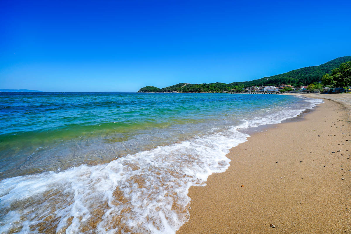
Breathtaking Beaches

Olympiada is a wonderful place, well known for its stunning sandy beaches with white and golden sand.
 
The main beach of Olympiada extends for 700 meters along the entire village, while it continues for about 1 km to the limits of the settlement, where it meets the Golden Coast. The sea is shallow for the first 50 meters from the shore and then deepens.
 
History & Culture

Visit Ancient Stagira

This ancient city is located near Olympiada, on a small, mountainous peninsula called “Liotopi” although the testimonies of antiquity said it was closer to the waterfront.
 
The city is well known as the birthplace of the philosopher Aristotle. Founded in 665 by Ionian settlers from Andros .
 
After the Persian wars it became a member of the Athenian Alliance, but rebelled against the Peloponnesian war and allied with the Spartans, which enraged the Athenians who besieged the city but to no avail.
 
Archaeological excavations began in 1990 and continue to this day, and have brought to light important parts of the ancient city, which you can admire during your visit there. You can visit, for example, Aristotle’s park, which is located in modern Stagira village hosted by experimental instruments operating under the natural laws which refer to his writings.
ESPA Banner
ESPA